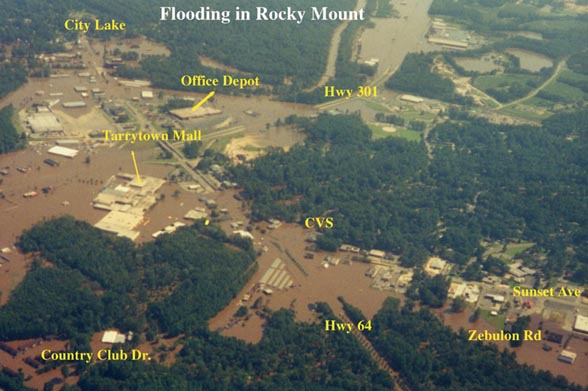
showing 30% of City Flooded
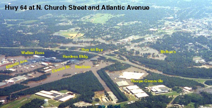
Flooding showing N. Church St. and Atlantic Avenue areas.
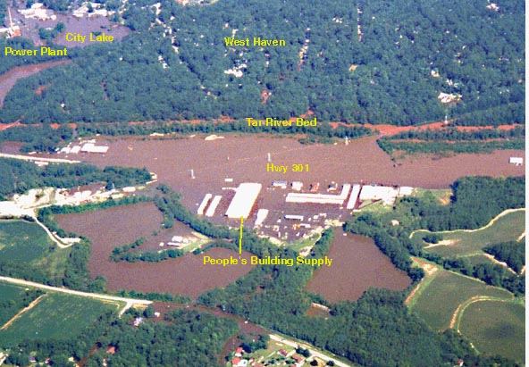
Hwy 301 near People's Building Supply
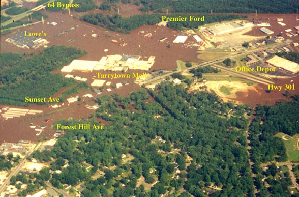
The enormous body of water formed by merger of Stony Creek (that skirted Zebulon Road
to Country Club Drive and on by Lowe's) with the Tar River that is normally in its banks
(seen here above the "H" in Hwy 301 on this map).
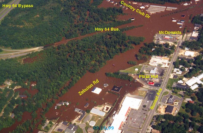
Hwy 64 at Zebulon Rd., Country Club Drive and Sunset Ave.
Photos made available by Carl Worsley

One of the largest Hurricanes on Record, Floyd
shown here coming up the East coast